
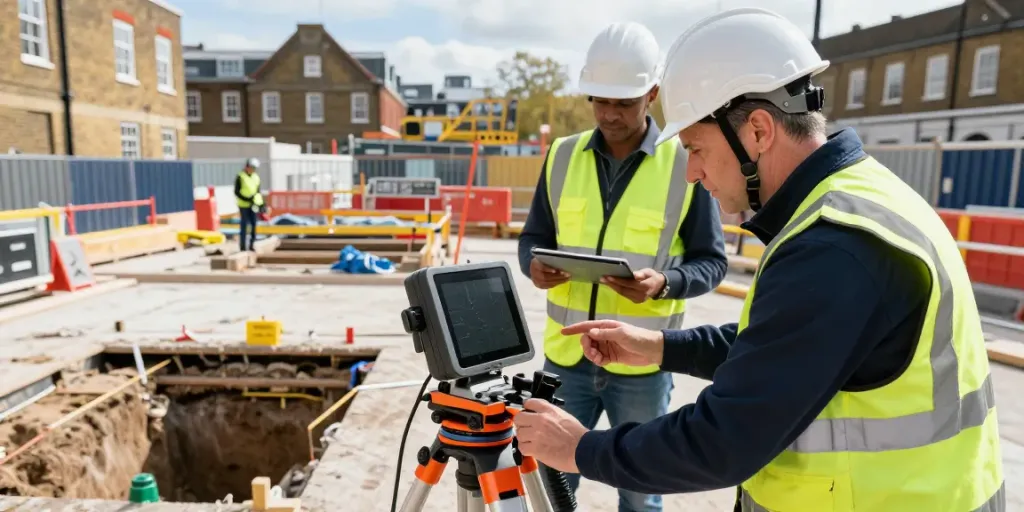
Understanding GPR Utility Surveys
Ground Penetrating Radar (GPR) Utility Surveys have become an essential tool in urban planning and infrastructural development, especially in densely populated areas like London. These surveys provide a non-invasive method to detect and map underground utilities, enabling construction professionals and engineers to avoid costly mistakes and ensure safety during excavation. With the rise in urban development projects, understanding GPR utility surveys has never been more critical. When exploring options, GPR Utility Survey London offers comprehensive insights into the capabilities and benefits of this advanced technology.
What is a GPR Utility Survey?
A GPR Utility Survey employs radar technology to ascertain the location and depth of subsurface structures. By transmitting electromagnetic waves into the ground, the radar detects variations in material density, providing real-time images of underground features. This technology is particularly effective for identifying pipes, cables, and other utilities that might not be visible or accessible through traditional survey methods.
Key Benefits of GPR Utility Survey London
Utilizing GPR technology offers several advantages:
- Non-destructive: GPR surveys do not require excavation, preserving the integrity of the landscape.
- Accuracy: High-resolution data provides precise depth and location of utilities, reducing the risk of damage during construction.
- Speed: GPR surveys can be conducted quickly, enabling faster project timelines and decision-making.
- Flexibility: The technology is adaptable for various environments, from urban settings to rural areas.
Comparison with Traditional Utility Mapping Methods
Traditional methods of utility mapping often involve physical excavation or the use of electromagnetic locating devices. While these methods have their place, they can be time-consuming and disruptive. GPR differs by offering:
- Real-time data collection without the need for ground disruption.
- A broader scope of detection that covers a larger area in less time.
- Greater capability to detect both metallic and non-metallic utilities.
Key Equipment and Tools for GPR Surveys
Essential GPR Tools and Technologies
The success of a GPR Utility Survey largely depends on the tools and technologies employed. Key equipment includes:
- GPR Antennas: Different frequencies (e.g., 100 MHz to 2 GHz) are used depending on the depth of investigation and the resolution required.
- GPS Systems: Integrated GPS allows for the precise mapping of underground utilities, overlaying survey data with geographical information.
- Data Acquisition Systems: These systems collect and process the radar signals, converting them into interpretable data.
Cost-effective Options for Budget-Conscious Surveys
For projects on a budget, various GPR solutions are available that provide excellent value without compromising on quality. Options such as renting equipment or using local GPR service providers can significantly reduce costs. Additionally, leveraging technological advancements can lead to more efficient surveys, leading to cost savings in the long run.
Comparative Analysis of GPR Devices
When considering GPR devices, it is essential to compare specifications and their suitability for specific projects. Factors to consider include:
- Frequency: Higher frequencies yield better resolution but less penetration depth, and vice versa.
- Portability: Lightweight and portable models are beneficial for urban surveys.
- User Interface: Intuitive software can enhance user experience and data interpretation.
Best Practices for Conducting a GPR Utility Survey
Planning and Preparation Steps
Thorough planning is crucial to the success of any GPR utility survey. Here are key steps:
- Site Assessment: Understanding the site characteristics and previous utility maps can inform survey strategies.
- Equipment Calibration: Ensure all equipment is calibrated according to manufacturer specifications to guarantee accuracy.
- Permitting: Verify any required permits or regulations, especially in urban areas with extensive underground infrastructure.
Executing the Survey: Techniques and Strategies
To execute a GPR survey effectively, surveyors should adopt specific techniques such as:
- Grid Patterns: Establishing a grid layout helps ensure comprehensive coverage of the survey area.
- Data Collection Techniques: Consistent movement speed and antenna height are critical for accurate data acquisition.
- Environmental Considerations: Be aware of weather conditions and soil types that might affect radar penetration.
Data Interpretation and Reporting
Interpreting GPR data requires expertise and experience. Key practices include:
- Layer Analysis: Distinguish between different material layers to identify types of utilities present.
- Collaboration: Work with engineers and planners to integrate survey findings into project designs.
- Accurate Reporting: Create detailed reports that summarise findings and provide context for decisions made during construction.
Common Challenges in GPR Utility Surveys
Identifying Underground Anomalies Effectively
Underground anomalies can sometimes lead to misinterpretations. Employ advanced software that helps in correlating survey data with existing utility maps for more accurate readings.
Addressing Environmental Factors
Environmental conditions, such as soil moisture content and temperature fluctuations, can influence GPR effectiveness. Understanding these factors and adjusting survey techniques accordingly enhances reliability.
Mitigating Survey Errors and Misinterpretations
To mitigate the potential for errors, always verify findings with follow-up investigations, using complementary methods such as electromagnetic surveys to confirm GPR results.
Future Trends and Developments in GPR Technology
Innovations in Ground Penetrating Radar for 2026
The GPR industry is rapidly evolving, with trends indicating enhanced data collection capabilities and improved software solutions that increase the accuracy of subsurface imaging.
The Role of AI in Enhancing Survey Accuracy
Artificial Intelligence is increasingly being integrated into GPR systems to assist in real-time data analysis, significantly improving the speed and accuracy of underground utility mapping.
Emerging Applications Beyond Utility Mapping
Future applications of GPR technology are expanding into areas such as archaeology, geology, and environmental studies, providing invaluable insights into subsurface conditions in various fields.
What are the typical costs of GPR Utility Surveys in London?
The cost of GPR utility surveys in London can vary significantly based on project size, depth, and complexity. Typically, projects can range from a few hundred to several thousand pounds. Factors influencing costs include location, the equipment used, and the expertise of the surveyor.
How accurate are GPR surveys compared to other methods?
GPR surveys are known for their high accuracy in detecting underground utilities, often outperforming traditional electromagnetic methods, especially in complex urban environments.
What are the regulatory requirements for GPR surveys?
Regulatory requirements for GPR surveys in London typically involve adherence to guidelines set by local authorities and utility companies. It is essential to ensure compliance with PAS128 standards for utility mapping.
How can GPR survey data be integrated into planning projects?
GPR survey data can garner immense benefits in planning projects by providing reliable information about existing utilities, which helps in minimising disruptions and optimising design layouts.
Are there specific challenges for urban GPR surveys?
Urban GPR surveys face unique challenges, including congested infrastructure and limited access points. Strategies such as phased surveying and collaboration with local authorities can mitigate these challenges effectively.